The PI and research team widely disseminated their findings, including organizing a seminar on methodologies and research experiences in geosciences at UNSCH. They also gave technical presentations at a variety of seminars and scientific events, including the AQUAFUTURA seminar of the National Meteorological Office (SENAMHI) and the National Congress of Environmental Engineering Students.
The research supported by this PEER project helped seven undergraduate and graduate students defend theses, and research team students participated in a training event organized by the National Drought Observatory. They also took part in training sessions in Colombia and Brazil.
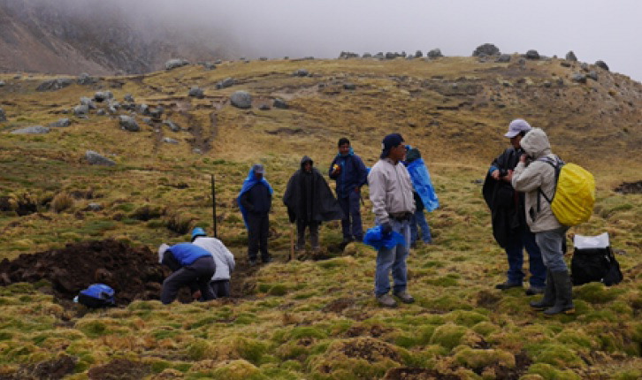
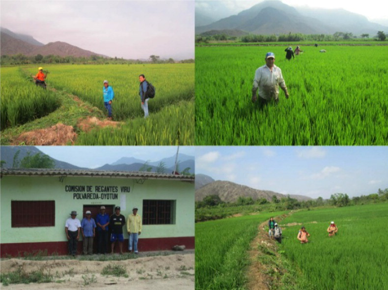
Dr. Willems worked closely on the project to share his findings and recommendations with relevant Peruvian government agencies and align his team’s efforts with their needs and interests. The project team members actively participated in and provided support to several governmental-led initiatives. One key activity involved implementation of the National Drought Observatory (ONS), an initiative led by ANA and including the participation of the Peruvian Meteorological Service (SENAMHI), the Ministry of Agriculture, Ministry of Economy, Ministry of Environment, the Peruvian Institute of Geophysics, and UNESCO’s International Hydrological Program (UNESCO-IHP). The satellite-based monitoring system for assessing the evolution of Andean headwaters (one of the milestone deliverables of this PEER project) and the drought indicators will feed the ONS. In collaboration with their colleagues at UNPRG, the PEER team also developed the land degradation map of Piura at a scale of 1:25000 for the Ministry of Environment. This map constitutes the country's effort in combatting desertification by providing more detailed information about the state of the agricultural soils of Piura. The researchers have begun collaborating with the technical committee for the national wetland inventory, which is formed by representatives from the Ministry of Environment, the ANA and the National Wildlife and Forest Service (SERFOR). Through this collaboration, Dr. Willems and his group will share their results and methodologies for characterizing Andean wetlands and help the government agencies complete the inventory of the country. Meanwhile, the team’s hydrological models of the Apacheta basin and the wetland distribution maps have also been used for providing information requested by the Regional Government of Ayacucho.
As part of the PEER project, the PI led the design process of a new Regional Research Institute for Water - Food - Energy Security (ir-NEXUS), holding meetings with governmental entities, private companies, NGOs, USAID and the U.S. State Department. A workshop with government stakeholders was organized to identify strategic research areas for this group. Dr. Willems and his colleagues continued their efforts under a PEER Cycle 5 project entitled AGUA-ANDES: Ecological Infrastructure Strategies for Enhancing Water Sustainability in the Semi-Arid Andes, which ran from January 2017 through January 2020.
PublicationsWilmer Moncada, Bram Willems, Alex Pereda, Cristhian Aldana, and Jhony Gonzales 2022. Tendencia anual, anomalías y predicción del comportamiento de cobertura de vegetación con imágenes Landsat y MOD13Q1, microcuenca Apacheta, Región Ayacucho.
Revista de Teledetección 59: 73-86.
https://doi.org/10.4995/raet.2022.15672 Raul Espinoza-Villar, Jean-Michel Martinez, Elisa Armijos, Jhan-Carlo Espinoza, Naziano Filizola, Andre Dos Santos, Bram Willems, Pascal Fraizy, William Santini, and Philippe Vauchel. 2018. Spatio-temporal monitoring of suspended sediments in the Solimões River (2000–2014).
Comptes Rendus Geoscience 350: 4-12.
http://dx.doi.org/10.1016/j.crte.2017.05.001 Bastian Manz, Sebastián Páez-Bimos and Natalia Horna, Wouter Buytaert and Boris Ochoa-Tocachi, Waldo Lavado-Casimiro, and Bram Willems. 2017. Comparative Ground Validation of IMERG and TMPA at Variable Spatiotemporal Scales in the Tropical Andes. J
ournal of Hydrometeorology 18: 2469-2489.
https://doi.org/10.1175/jhm-d-16-0277.1
Rafael de Grenade, Joshua Rudow, Rossi Taboada Hermoza, Maria Elena Adauto Aguirre, Christopher A. Scott, Bram Willems, Jennifer L. Schultz, and Robert G. Varady. 2017. Anticipatory capacity in response to global change across an extreme elevation gradient in the Ica Basin, Peru.
Regional Environmental Change 17: 789-802.
https://doi.org/10.1007/s10113-016-1075-3
Maria Carmen Lemos, David Manuel-Navarrete, Bram Leo Willems, Rolando Diaz Caravantes, and Robert G Varady. 2016. Advancing metrics: models for understanding adaptive capacity and water security.
Current Opinion in Environmental Sustainability 21: 52-57.
http://dx.doi.org/10.1016/j.cosust.2016.11.004