|
Cycle 4 (2015 Deadline)
Application of geodetic, satellite remote sensing and physical modeling tools for management of operational groundwater resources in the Red River Delta, Vietnam
PI: Nguyen Duc Luong (luongnd1@nuce.edu.vn), Institute of Environmental Science and Engineering , National University of Civil Engineering (NUCE)
U.S. Partner: Faisal Hossain, University of Washington
Project Dates: October 2015 - March 2019
Project Overview 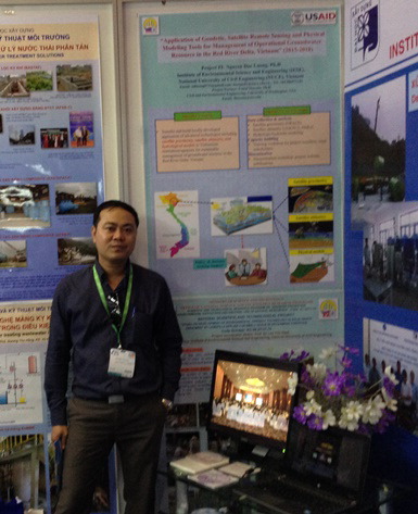
Dr. Luong presents a poster on his PEER project at the VietWater Expo & Forum 2015. |
|
The overall goal of this project was to transfer and build locally-developed applications of advanced technologies, including GRACE satellite gravimetry, satellite altimetry, and hydrologic and hydraulic models to Vietnamese institutions and agencies that manage groundwater resources in the Red River Delta (RRD) of Vietnam. In this project, the Institute of Environmental Science and Engineering (IESE) and the National Center for Water Resources Planning and Investigation (NAWAPI) partnered with the NASA-supported project “NASA WATER—Towards Operational Water Resources Management in South Asia Exploiting Satellite Geodetic and Remote Sensing Technologies (2014-2018),” which is led by Dr. Faisal Hossain at the University of Washington (UW). This three-year project was the first ever study adopting the promisingly integrated approach of geodetic, satellite remote sensing, and physical modeling tools for groundwater assessment in Vietnam. It provided a totally new spatial and temporal dataset for groundwater monitoring in the RRD, where groundwater is being over-exploited for domestic use and intensively irrigated agriculture activities. These efforts will support NAWAPI and relevant governmental agencies in their decision making activities for sustainable management of groundwater in this region and Vietnam. To achieve its goal, this project provided technical training for IESE and NAWAPI staff members on independently managing and interpreting data from geodetic and satellite remote sensing, hydrologic, and hydraulic modeling tools for extracting regional and local-scale changes in groundwater storage anomalies for the RRD. This would then facilitate making projections for water resources planning at 30- to 180-day timescales for the RRD.
Final Summary of Project Activities
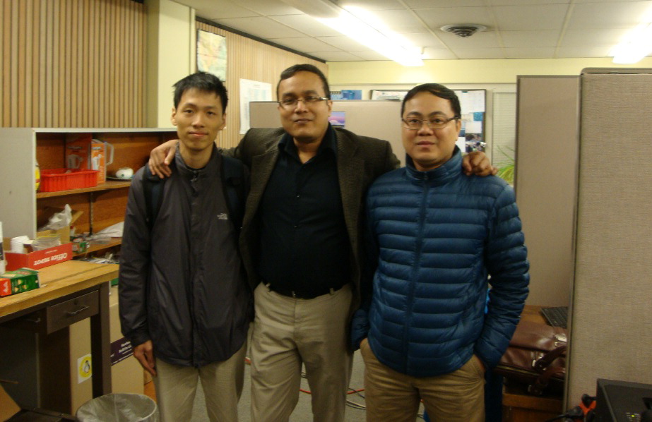
“(L-R) Nguyen Hoang Hiep, Faisal Hossain, and Nguyen Duc Luong during the visit of the Vietnamese researchers to the University of Washington, March-April 2016 (photo courtesy of Dr. Luong).
|
Over its duration of more than three years, from October 2015 to March 2019, Dr. Luong and his team on this now-completed PEER project achieved the following key results and impacts:
• Scientific findings: Using the VIC hydrological model and GRACE satellite data, they have performed simulations for Red River flows and assessed groundwater resources for the Red River Basin. They shared these findings with their local partners (NAWAPI and NCHMF) and other national and local stakeholder agencies for reference and use in their ongoing operational tasks with regard to water resource management.
• Publications: Based on their PEER project findings, as of February 2019 the team had published three joint peer-reviewed papers involving their U.S. partner Dr. Faisal Hossain, plus another peer-reviewed paper individually authored by Dr. Luong. Their work also appeared in three published proceedings.
• Educational impacts: With the accumulated knowledge and skills they gained in the application of the VIC hydrological model and satellite tools for water resource management, the PEER team has developed new courses that will be offered to undergraduates at NUCE as part of the program “Environment and Urban Sustainability.” The curriculum is expected to be launched in the summer of 2020 and will include newly designed courses on Environmental Systems Modelling, Application of Geographic Information Systems (GIS), and Remote Sensing in Natural Resources and Environmental Management, thus sharing the benefits of the project with a new generation of Vietnamese students.
• Tools and products: In close collaboration with their U.S. partner, Dr. Luong and his colleagues developed real-time web-based water forecasting systems based on hydrologic modeling, weather model data, and satellite observations. Although the PEER project has ended, these systems continue to be to provide useful data and results for NUCE and other research institutions and agencies in both their research and agency operations. The system designed for NUCE is available at (http://forecast.water.numos.org/) and the system for NAWAPI is at (http://forecasting.vaci.org.vn/).
• Outreach and collaborations: Through their project events and participation of project members in several conferences and workshops, the team has widely disseminated their results and established valuable connections for future collaboration with local, national, and international research institutions, universities, governmental agencies, non-governmental organizations, and other stakeholders. They continue to work with U.S. partners on ongoing projects supported by the National Science Foundation and the National Aeronautics and Space Administration.
• Capacity building: Through their PEER project, Dr. Luong and his group have built valuable capacity for their project members and students on using modelling and satellite tools for water resources research. They have also provided capacity building for relevant local, national, and regional agencies and institutions. Their group’s website at www.numos.org will continue to serve as a resource and focal point for the NUMOS (NUCE Modeling and Earth Observation System) research group. This is one of the few research groups in Vietnam currently working on the modeling and earth observation system at present. They also plan to upload all of their project materials and findings on the website to make them freely available to the general public and broaden the impact of the project. As Dr. Luong confirms, all of their efforts have been devoted to facilitating true empowerment for the people of Vietnam and ensuring the long-term sustainability of satellite-based ground water management in the country and the region.
In February 2019, the journal EOS Earth and Space Science News published a joint article by this team on the flood forecasting system they developed as part of this project, entitled "When Floods Cross Borders, Satellite Data Can Help." Congratulations to Dr. Luong, Dr. Hossain, and colleagues!
Publications
Nguyen Hoang Hiep, Nguyen Duc Luong, Tran Thi Viet Nga, Bui Thi Hieu, Ung Thi Thuy Ha, Bui Du Duong, Vu Duc Luong, Faisal Hossain, and Hyongki Lee. 2018. Hydrological model using ground- and satellite-based data for river flow simulation towards supporting water resource management in the Red River Basin, Vietnam. Journal of Environmental Management 217: 346-355. https://doi.org/ 10.1016/j .jenvman.2018.03.100
Luong, N. 2018. Application of VIC hydrological model for simulating river flow of red river system to support water resource management. Journal of Science and Technology in Civil Engineering (JSTCE) - HUCE 11(6): 198-204. https://stce.huce.edu.vn/index.php/en/article/view/958
Faisal Hossain, Safat Sikder, Nishan Biswas, Matthew Bonnema, Hyongki Lee, N.D. Luong, N.H. Hiep, Bui Du Duong, and Duc Luong. 2017. Predicting water avaialbility of the regulated Mekong River Basin using satellite observations and a physical model. Asian Journal of Water, Environment, and Pollution 14(3): 39-48. https://doi.org/10.3233/AJW-170024
Back to PEER Cycle 4 Grant Recipients
|


