|
Cycle 5 (2015 Deadline)
Satellite enhanced snowmelt flood and drought predictions for the Kabul River basin with surface and groundwater modeling
PI: Jay Sagin, Nazarbayev University (Kazakhstan), with co-PIs Mohammad Najaf (deceased), Kabul Polytechnic University (Afghanistan), and Muhammad Abid, COMSATS, (Pakistan)
U.S. Partner: Jennifer Jacobs, University of New Hampshire
Project Dates: March 2017 - December 2020
Project Overview
The overall objectives of this research were to develop (1) the Kabul River Basin (KRB) flood prediction models using NASA satellite observations that capture the magnitude, timing, and spatial distribution of watershed scale parameters; and (2) combined surface and ground water modeling and prediction analyses. The project aimed to develop the integrated surface and groundwater modeling for the transboundary (Pakistan upstream and Afghanistan downstream) KRB with satellite enhanced snowmelt flood and drought predictions. The researchers applied advanced NASA satellite data to track snow, snow melting, floods, surface water coverage, and droughts over the KRB. They adapted cost-effective approaches using remote sensing data, with expertise provided by the U.S. partner Dr. Jacobs, based on her experience working on the NASA-supported project "Satellite Enhanced Snowmelt Flood Predictions in the Red River of the North Basin, USA." A lack of accurate snow depth and snow water equivalent data and a lack of understanding of snowmelt processes and soil infiltration during soil freeze and thaw events in the KRB inhibit the ability to improve flood predictions. This project team worked to improve the models by using satellite observations that capture the magnitude, timing, and spatial distribution of watershed-scale snowmelt parameters, as well as antecedent soil conditions. Most of the existing water-related research models were developed with separate components for the surface water and the groundwater, but this project combined them into a more comprehensive model, which should facilitate better prediction analyses.
Beyond the capacity building impacts for project participants and improved modeling technologies, the project promoted better regional transboundary water cooperation outside of high-level intergovernmental channels by providing a platform for interactions among academia and community-level water management structures from Afghanistan, Kazakhstan, Pakistan, and the United States. University-led forums were be organized to promote improved sustainable management of shared water resources within the context of climate change in Central and South Asia.
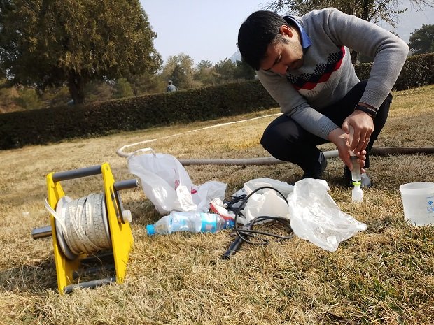
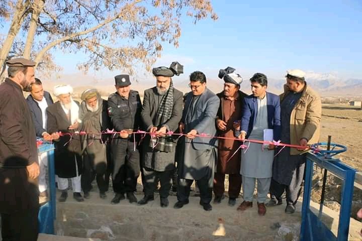
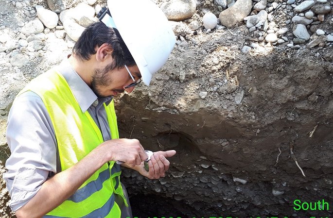
 |  |  | | The project team meets with the local populace at various locations while also conducting fieldwork and site sampling (photos courtesy of Dr. Sagin). |
Final Summary of Project Activities
This project accomplished its goals to develop Kabul River Basin flood prediction models, and combined surface and ground water modeling and prediction analyses. The research outputs were shared with local stakeholders and published in a series of published in a series of 12 peer-reviewed articles. The data and conclusions are also available on the project website, as is a list of over 30 early career researchers who received training and practical experience in water resources, and set up the regional cooperation network with the joint publication works.
The research outputs were also adapted for the user friendly localized TVET (Technical and Vocational Education and Training) programs and used for training purposes. The TVET support program will continue, and at the time the final report was submitted, the project team was planning to set up a similar support program in cooperation with the Central Asia University Partnerships Program (UniCEN) and the Know Your Well program run by the University of Nebraska Lincoln.
Moving forward, the project team will continue its work under the International Partnerships for Sustainable Innovations program. They are also expanding the practical applications of the research outputs and are in negotiations with the U.S. Valmont Valley Corporation, which is planning to build irrigation factories in Central Asia. These sophisticated irrigation technologies require proper water resource studies in Central Asia, including Afghanistan but the countries are currently missing the proper irrigation TVET support programs. The project team hopes to connect their established partnership and USAID PEER research work outputs to the irrigation education program, and eventually prepare the user-friendly TVET support programs for farmers in Central Asia.
Publications
Hussain Ali Jawadi, Hasan Ali Malistani, Mohammad Anvar Moheghy, and Jay Sagin. 2021. Essential Trace Elements and Arsenic in Thermal Springs, Afghanistan. Water 13, 134. https://doi.org/10.3390/w13020134
Muhammad Abid, Umer Muhammad, and Zaineb Abid. 2021. Potential of floating photovoltaic technology in Pakistan. Sustainable Energy Technologies and Assessments 43, 100976. https://doi.org/10.1016/j.seta.2020.100976
Muhammad Abid, Zaineb Abid, and Umer Muhammad. 2021. Floating Photovoltaic System Technology—Prospects of Its Implementation in Central Asian, South Asian and South East Asian Region. Chapter in Energy and Environmental Security in Developing Countries. Advanced Sciences and Technologies for Security Applications. Springer, Cham. https://doi.org/10.1007/978-3-030-63654-8_26
Zaineb Abid and Abid Muhammad. 2021. Effects of Climate Change on Women—Adaptation and Mitigation. Chapter in Energy and Environmental Security in Developing Countries. Advanced Sciences and Technologies for Security Applications. Springer, Cham. https://doi.org/10.1007/978-3-030-63654-8_20
Hussain Ali Jawadi, Jay Sagin, and Daniel D. Snow. 2020. A Detailed Assessment of Groundwater Quality in the Kabul Basin, Afghanistan, and Suitability for Future Development. Water 12, 2890. https://doi.org/10.3390/w12102890
Muhammad Hasan Ali Baig, Muhammad Abid, Muhammad Roman Khan, Wenzhe Jiao, Muhammad Amin, and Shahzada Adnan. 2020. Assessing Meteorological and Agricultural Drought in Chitral Kabul River Basin Using Multiple Drought Indices. Remote Sensing 12, 1417. https://doi.org/10.3390/rs12091417
Back to PEER Cycle 5 Grant Recipients
|
|
|
|


