|
Cycle 6 (2017 Deadline)
Unmanned aerial systems-based assessment of tree cover and deforestation dynamics in Bangladesh
PI: A.B.M Kamal Pasha, drpasha@daffodilvarsity.edu.bd, Daffodil International University
U.S. Partner: Demetrios Gatziolis, The United States Forest Service
Project dates: December 2017 - June 2022
Project Overview
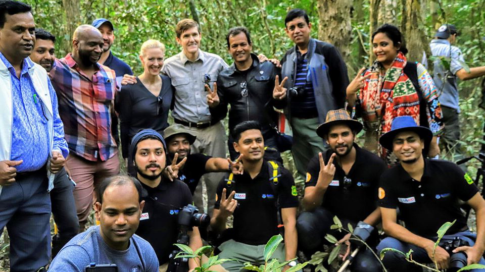
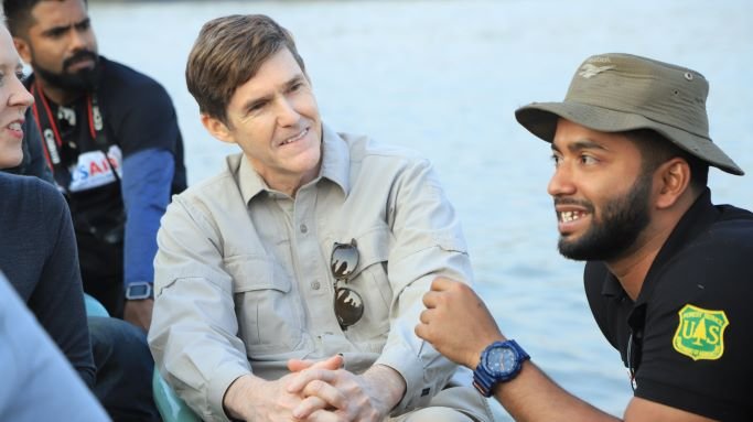
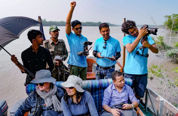
 | | USAID and NAS team visiting PI Dr. Pasha at DIU, Bangladesh, November 2019
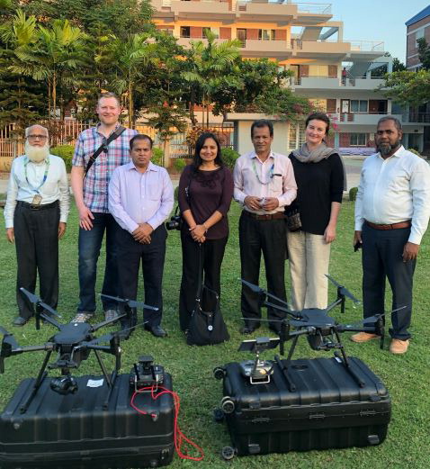
| | 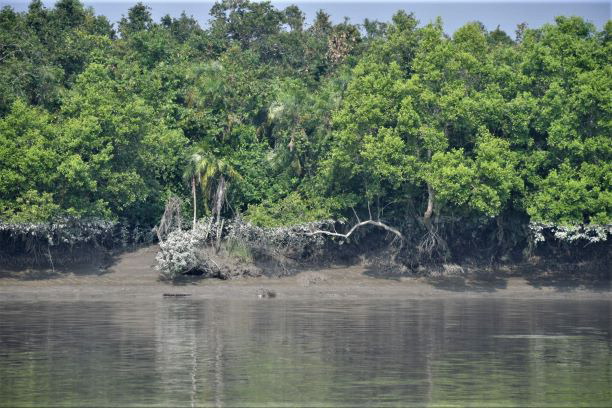 | | | Study area (red oval) in the Sundarbans (mangrove) forest of Bangladesh [courtesy of Dr. Pasha] | | 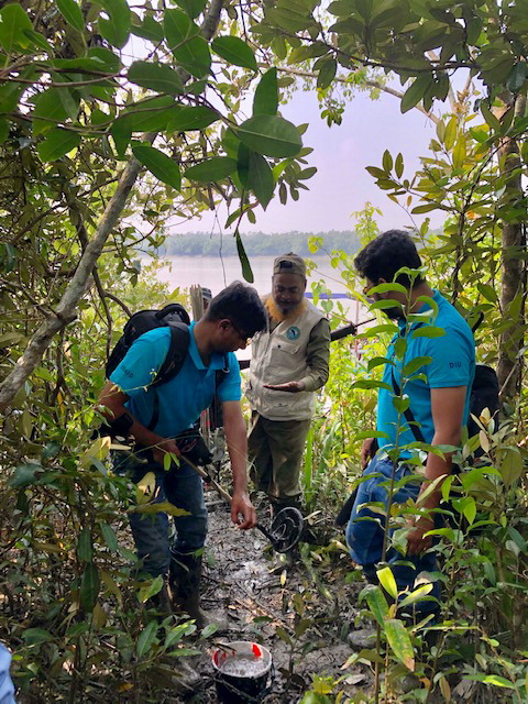 | | | The team enters Mangrove forest in the Sundarbans. Photo credit: Lina Stankute-Alexander (NAS) November 2019 | | 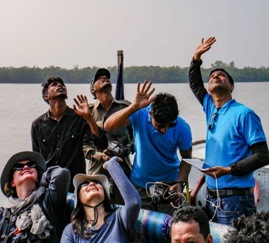 | | | | | | | | The main advantages of photogrammetry based on unmanned aerial vehicles (UAVs, or drones) compared to traditional aircraft imaging campaigns are low cost and flexibility. They can also be deployed at easily customizable above-canopy altitude, camera orientation, trajectory, and speed. They are thus ideal for imaging small areas of forests, such as over individual tree stands, management units, or inventory plots. Most developing countries do not yet have the capacity or knowledge base to support modern forest inventories and typically depend on satellite imagery and applications developed elsewhere to meet their needs, including the obligation to report on the status of their forests if they participate in international initiatives for reducing emissions from deforestation and forest degradation (REDD). The advent of novel, inexpensive technologies, including UAVs, and the development of affordable software capable of performing complex photogrammetric tasks hold promising potential into assisting the assessment of forest resources in developing countries and facilitating their verifiable participation in efforts to mitigate the effects of deforestation and forest degradation.
In this project, the PI Dr. Pasha and his team devised and optimized a fully-automated UAV-based image acquisition protocol compatible with generating comprehensive, high-density, precisely geo-referenced point clouds representing forest canopies for areas in selected locations in the Sal and Sundarbans forests. The researchers generated canopy surface and canopy height rasters for each selected inventory plot and its surroundings, as well as estimates of canopy cover for each subplot, and compared them to those obtained by inventory personnel during field visits.
Final Summary of Project Activities
The PEER researchers undertook field trips to collect data, covering a wide range of different forest plots from Tambulbunia, Horintana, Shapla, Kokilmoni, Dubla, Harbaria, Jhapshi, Nondobala, Moraposhur, and Hiron Point, gathering the largest and most precise sets of drone data over the largest mangrove forest on earth. Among other results, the team observed unexpected findings in terms of tree composition and variation. The researchers processed the raw data in partnership with the Bangladesh Forest Department (BFD). In the process, they shared their data analysis methods with BFD staff and helped them develop and train their drone patrol team, including a newly commissioned drone for patrolling the Sundarbans. Dr. Pasha and his colleagues continued to rely on BFD's commitment to give the PEER team access to the Department’s central remote sensing lab, where the team can access the needed data and conduct post-campaign data processing and analysis.
The most important impact of this project was the team’s key role in helping to get a new drone regulation law written and passed in Bangladesh in 2020, opening up a new window of opportunity for future researchers who are planning to use drones as a tool and bridging the gap between policymakers and the research community in Bangladesh.
The PEER project also contributed to student training by involving them in research trips, including hands-on training on field data collection protocols. Dr. Pasha and the other senior researchers on the project also updated curriculum modules for forestry, GIS, and remote-sensing courses at their university. Two research team members joined the USAID Research Technical Assistance Center (RTAC) initiative, and the experience they gained on the PEER project helped them in winning acceptances to PhD programs in U.S. universities.
|
|
|
|