|
Cycle 1 (2011 Deadline)
REDD based forest expansion, food consumption, and reduced emissions agricultural policies (REAP) in the Ecuadorian Amazon PI: Carlos Mena, Universidad San Francisco de Quito (USFQ) US Partner: Thomas Rudel, Rutgers University Project Dates: May 2012 - November 2015 Project Overview 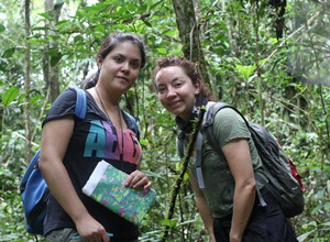
Project team members Carolina Sampedro and Alexandra Guevara during fieldwork (Photo courtesy of Carlos Mena).
|
In tropical forest frontiers, agricultural policies that encourage cultivation increase greenhouse gas emissions. Forest policies that encourage an expansion in forest cover reduce greenhouse gas emissions but can create risks for food security. Can these contrasting goals be reconciled? This project aimed to inform the current debate by proving links between payments for ecosystems services (i.e., Reducing emissions from deforestation and forest degradation or "REDD+") and the production of foodstuffs using emergent silvopastoral landscapes (pastureland with increasing forestation) in the Ecuadorian Amazon. The emergence of these new forested landscapes is viewed by these researchers as both an opportunity for REDD+ due the characteristics of these landscapes as a carbon sink and as a natural experiment to explore the relationship between the expansions of forested landscapes and the production of food. The project sought to identify the extent and drivers of silvopastoral landscapes, identifying how food consumption and production patterns are affected by the emergence of silvopastoral landscapes, and develop an emissions profile of peri-urban and urban farmers with an eye towards providing them an equitable distribution from the benefits of REDD+. The researchers focused on two main areas of the Ecuadorian Amazon: Coca and Macas. They share key characteristics, including high population growth, high urban expansion, and the emergence of silvopastoral landscapes, but differ in several respects. Coca is the center of oil exploration and extraction in Ecuador, which is a driver of agricultural expansion or land abandonment. Macas, on the other hand, is undergoing agricultural change due to international out migration from agricultural areas. The PEER team used remote sensing, household surveys, and complex systems modeling to study impacts and sought to generate recommendations for reduced-emissions agricultural policies for Ecuador and the Amazon in general. Final Summary of Project Activities The research team estimated the total amount of carbon released into the atmosphere due to deforestation in the Ecuadorian Amazon by the year 2038, using a model to find the probability of land use change between time periods, validating using existing vegetation maps. The regions where most land use change was likely to occur were identified and then aggregated to a final prediction map. These areas were overlaid on a pre-existing baseline carbon map (MAE & FAO, 2014) to estimate the amount of carbon that would be released into the atmosphere by the year 2038. The team ran a simulation of deforestation rates in the Amazon region under two different scenarios. The first assumed existing protected areas are left intact and free from any deforestation while the second will examine the changes that could occur if protected areas are subject to deforestation. This will estimate the amount of carbon emissions that can be controlled in protected areas when REDD+ guidelines and regulations are implemented in contrast to the current deforestation trend. The PEER project team has managed to work with and through an extensive network of actors and organizations partners in the Ecuadorian Amazon, including during a two-day workshop in Puyo, Pastaza Province, on June 25-26, 2015. The workshop introduced Geographic Information Systems tools to generate a discussion on the main needs of the communities and what applications of the technology could be used in terms of the management of their territories and resources. Researchers also held several meetings with the Ministry of Environment and the Ecuadorian Institute of Agricultural Research (INIAP) to explain the products of the project and coordinate activities, developing policy briefs to be given to the Ministry and INIAP. They also worked actively with Frente de Defensa de la Amazonía and the Red Angel Shingre, two local social organizations that support the project. PublicationsA. Lerner, T. Rudel, L. Schneider, M. McGroddy, D. Burbano, and C.F. Mena. 2015. The Spontaneous Emergence of Silvopastoral Landscapes in the Ecuadorian Amazon: Patterns and Processes. Journal of Regional Environmental Change 15: 1421–1431. https://doi.org/10.1007/s10113-014-0699-4 C.F. Mena, A. Guevara, and C. Sampedro. 2014. Exploring Linkages Between Land Use, Conflicts, and Oil Extraction in the Ecuadorian Amazon. Paper presented at the Annual Meeting of the Association of American Geographers, Tampa, Florida, April 8-12, 2014. C.F. Mena, A. Guevara, and C. Sampedro. 2013. Linking people, oil and silvopastoral landscapes: the case of the Orellana province in the Ecuadorian Amazon. Paper presented at “Pastures, Climate Change, and Sustainable Intensification in the Tropics: An international workshop,” International Center for Tropical Agriculture, Cali, Colombia, May 28-29, 2013. Back to PEER Cycle 1 Grant Recipients
| 


