Cycle 1 (2011 Deadline)
A collaborative approach towards integrated water resources management in the Litani River basin: opportunities for climate change adaptation and socioeconomic growth
PI: Mutasem El Fadel, American University Beirut
U.S. Partner:
James Smith, Princeton University
Project Dates: May 2012 - June 2017
Project Overview
Building on USAID’s past and on‐going programs in the Litani river basin in Lebanon, this project will study the vulnerability of the Litani to climate change with an emphasis on water resources and quality, agriculture productivity and food security, and public health protection. These researchers will work to provide a framework integrating climate change vulnerability assessment and adaptation using advanced simulation tools with decision support systems. These data will then be used to develop policies and investment options tied to socioeconomic improvement through cost benefit analyses. The project should enhance water quality management in the Litani basin while providing a collaborative platform for application and adaptation of new technologies as well as capacity building.
Specific activities to be carried out include applying the Weather Research and Forecasting (WRF) model of the U.S. National Center for Atmospheric Research in order to downscale climate change predictions to a watershed river scale for vulnerability assessments. The U.S. partners on this project are currently using the WRF model to conduct a similar vulnerability assessment of the water cycle in the Baltimore area, so their experience should be helpful to the Lebanese group as they strive to produce the first detailed, high-resolution evaluation of the impacts of climate on the hydrology of Lebanon in general and the Litani basin in particular. Based on the results of the climate vulnerability simulations, the researchers will subsequently define and analyze various adaptation strategies, focusing on such aspects as agricultural yields, alternative crops, and water management practices. Risk and socioeconomic assessments of climate change impacts will be conducted, and the various vulnerability, adaptation, and socioeconomic indicators will be integrated into a decision support system to promote sound, evidence-based policy creation. Through this collaborative project, the Lebanese researchers and students involved will gain experience with cutting-edge tools for assessing climate change impacts and vulnerability and will have enhanced capacity to contribute to strategic policy planning in Lebanon with regard to climate change and its effects.
 |  |
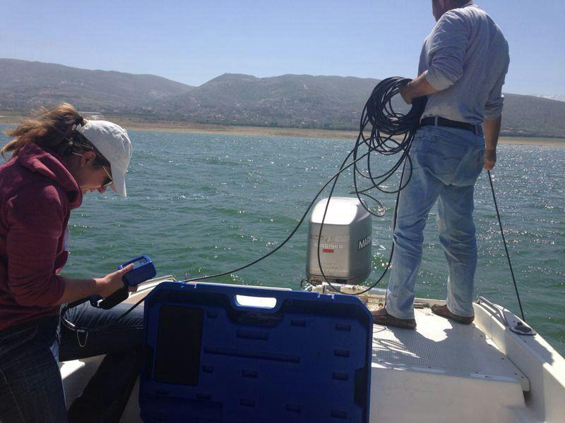
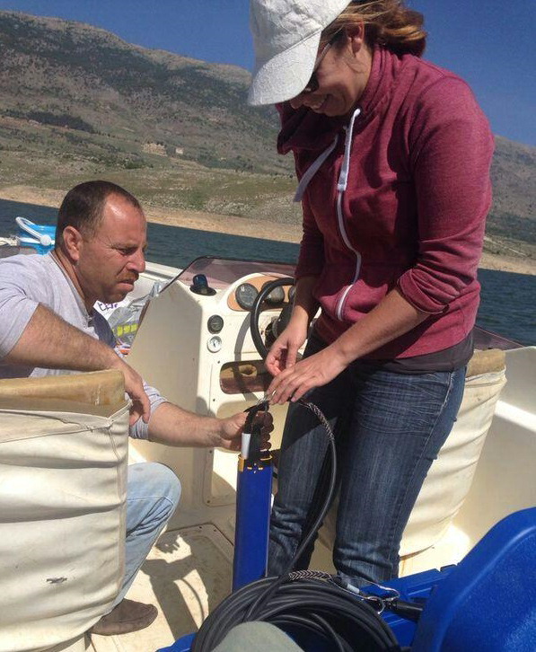
| The project team collects data at the Qaroun Reservoir to measure water quality. |
Final Summary of Project Activities
The PEER project has ended and the following six activities have been completed:
Activity 1: High-resolution dynamic downscaling to assess the impacts of climate change in regions of complex dynamicsHigh resolution dynamical downscalling is conducted for the past and the near future climates under two Representative Concentration Pathways (RCP4.5 and RCP8.5) over Lebanon, using the Weather Research and Forecast (WRF) model forced by the High-Resolution Atmospheric Model (HiRAM). For this purpose, WRF performance for the study area was evaluated by downscaling National Centers for Environment Prediction Final Analysis model results, for a mild and wet year and a hot and dry year, to three horizontal resolutions of 9, 3 and 1 km. Temperature, precipitation and wind were compared at different time scales against observational data in the study area. Then, a set of ten downscaling simulations at 3 km resolution were performed using WRF driven with HiRAM, to generate future climate projections of annual and seasonal temperature and precipitation changes over Lebanon. Two past years were simulated to evaluate the model and to serve as a baseline scenario. The simulations results were finally used as weather input to a soil-plant growth simulator (CropSyst) to characterize silage maize agricultural yield and water balance in a pilot area located in the semi-arid central inland region.
Activity 2: Reservoir eutrophication dynamics:The role of excessive nutrient loading and temporal changes in climate forcingEutrophication of freshwater bodies is a major concern that has been hampering water management efforts globally. Remote sensing has the potential to assess changes in eutrophication status in infrequently monitored systems. In this study, empirical Landsat-based algorithms were developed for Qaraoun Reservoir in Lebanon in an effort to measure chlorophyll-a, total suspended solids, and secchi disk depth from spectral reflectances. Developed empirical algorithms were then used to hindcast changes in water eutrophication status, water temperature and reservoir volume across the Landsat image record (1984-2015). Field physio-chemical and biological data were used to understand the driving forces responsible for the marked increase in cyanobacteria in the reservoir. A Structural Equation Model (SEM) was developed to link cyanobacterial biovolume to the physio-chemical conditions in Qaraoun.
Activity 3: Efficacy of algaecides on algal blooms in hypereuthrophic lakesCyanobacterial blooms are an emerging problem worldwide, affecting many important freshwater systems. The proliferation of these blooms has been linked to public health concerns and to the impairment of the designated uses of several fresh water systems. Several studies have linked the increase in bloom frequency to anthropogenic activities, particularly increased nutrient loading. While basin-level management measures that aim to control nutrient loading are the most effective on the long-term, they are hard to implement given socio-economical constrains. As such, the use of chemical algaecides can provide a viable short-term mitigation measure that aims to control these blooms. In this study, the efficacy of three algaecides, namely Copper Sulfate, Potassium Permanganate, and Diquat, was examined with regards to controlling two toxin-releasing cyanobateria, Aphanizomenon flos-aquae and Microcystis aeruginosa. The efficacy of each algaecide was quantified under laboratory conditions over a range of selected dosages.
Activity 4: Dew as an adaptation measure for climate changeDew is a frequent atmospheric phenomenon in which water droplets naturally condense upon passively cooled surfaces. Pilot studies showed small yet significant yield, particularly in their contribution to the water budget. This activity couples knowledge from hydrology, geostatistics, modeling, and instrumentation to assess the long term potential of dew and its feasibility for crop and reforestation irrigation.
Activity 5: Watershed Modeling using integrated hydrologic information systemProjected climate changes are expected to influence the hydrologic regimes of most river basins and increase the vulnerability of water resources systems worldwide. The Upper Litani River Basin (ULRB), with a semi-arid climate, is expected to be equally influenced by projected climate change. The need to assess these changes is critical for the development of adaptation strategies and management plans for the basin. The successful implementation of such an assessment requires the implementation of a National Hydrologic Information System (NHIS) framework and the development of a National Hydrologic Geodatabase (NHG) for the evaluation of catchment hydrology and water resources. As such, an integrated hydrologic and water resources model for the ULRB was established using the Soil Water Method (SWM) under the Water Evaluation and Planning (WEAP) model. The model was calibrated (1952-1962) and validated (1962-2010) against streamflow using an integrated WEAP-PEST approach.
Activity 6. DisseminationThe project results were disseminated at both the national and international levels through peer reviewed publications (papers, book chapters, proceedings), presentations at conferences, workshops, video production.


