U.S. Partner: Falk Amelung, University of Miami
Project Dates: October 2014 to February 2017
 |
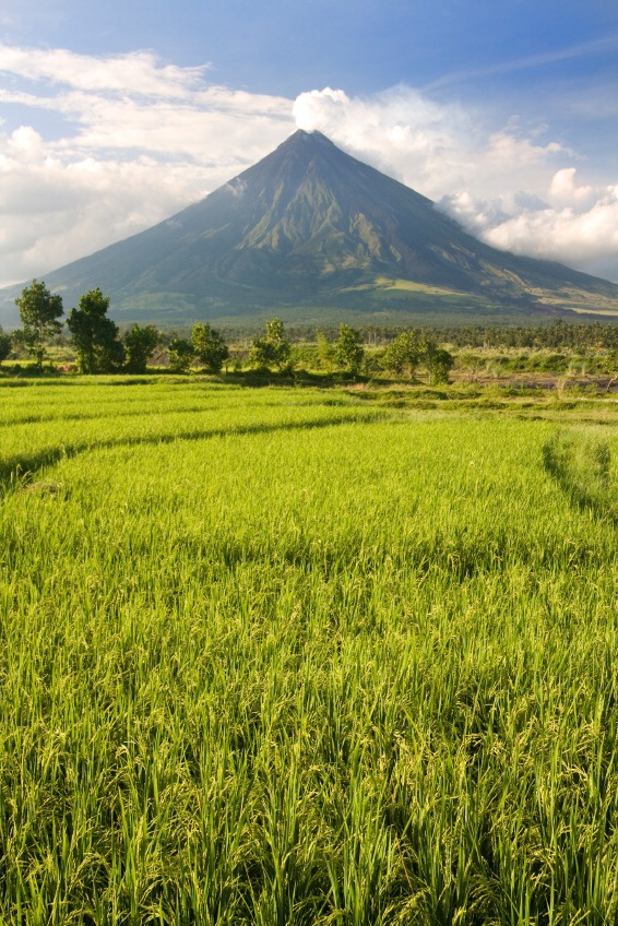
| Mount Mayon in the Philippines |
Project OverviewOne of the hazards associated with steeply sided volcanoes is large-scale failure of their edifices. Known occurrences of sector failure in volcanoes worldwide occur with or without associated eruptions. To investigate the impact of tectonics on the stability of more than 200 volcanoes in the Philippines, a persistent scatterer interferometric synthetic aperture radar (PSInSAR) will be used to measure ground motion in the region where its edifice is erected. The fault blocks traversing volcanoes will be examined in terms of sense and rate of movement using available time-series radar images through PSInSAR. The project will lead to a better understanding of precursory deformation of large-scale volcanic landslides and possibly help predict eruptions, as was the case for the 1980 Mt. St. Helens catastrophic event.
The research project aims to detect incipient movement of volcanic landslides, understand deformation patterns and structures preceding large scale volcano instability, and contribute to predictive capability through improved knowledge of deformation patterns within volcano flanks. All of these can subsequently be used for volcano hazard assessment. With this research project, it is expected that InSAR and other related technologies can be further developed and applied in the Philippines. This study is expected to enhance current understanding of volcanic behavior, its relation to tectonic processes, and how it may affect the mechanism of failure brought about by instabilities induced by these processes. With the multidisciplinary approach of this study, the research team expects to mitigate hazards using state-of-the-art technology and identify disaster-prone areas for longer-term community development planning. In addition, the project will lead to the establishment of the Southeast Asia Geohazard Natural Laboratory of GEOSS to secure continuing InSAR coverage.
Final Summary of Project Activities
Thanks to their funding from PEER, Dr. Lagmay and his team were able to improve their technical capability in processing InSAR data from satellite images. The collaboration with Dr. Falk Amelung of the University of Miami expanded their network and took advantage of UM's computing and other facilities. Researcher Jolly Joyce Sulapas visited the laboratory of Dr. Amelung at the University of Miami in early 2017, where she learned to access and use their methods in generating interferograms and time-series velocity maps, and was introduced to concepts on magmatic source modeling.
Through the data and technical skills acquired from this project, the researchers can provide monitoring and analysis of ground deformation related to volcano deformation and tectonic fault movement, which could potentially result in catastrophic earthquakes.
The team was able to expand the potential use of InSAR research beyond the original scope of the project, including in the areas of agriculture, urban planning and natural resource management. Taking advantage of currently free and open access SAR satellite imagery, such as those from the ESA's Sentinel mission, will allow the researchers to monitor numerous areas at a minimal cost.
The team began a collaboration with the Philippines Department of Agriculture to detect and monitor ground subsidence induced by groundwater extraction in agricultural areas, both to evaluate the sector’s current groundwater usage and assess new irrigation programs' use of these valuable resources. They also established a working relationship with the Rapid Analysis and Spatialisation Of Risk (RASOR) Project to write proposals for funding from World Bank and other agencies to develop comprehensive tools for disaster risk assessment efforts in the Philippines, and potentially the region as well.
PublicationsEco RC, Rodolfo KS, Sulapas JJ, Morales Rivera AM, Lagmay AMF, et al. 2020. Disaster in Slow Motion: Widespread Land Subsidence in and Around Metro Manila, Philippines Quantified By Insar Time-Series Analysis.
JSM Environ Sci Ecol 8(1): 1068.
https://doi.org/10.47739/2333-7141/1068 Anieri Morales, Falk Amelung, and Rodrigo Eco. 2015. Volcano Deformation and Modeling on Active Volcanoes in the Philippines from ALOS InSAR Time Series. Proceedings of the Conference: Fringe2015: Advances in the Science and Applications of SAR Interferometry and Sentinel-1 InSAR Workshop.
https://doi.org/10.5270/Fringe2015.pp302
Back to PEER Science Cycle 3 Grants 


