|
Cycle 4 (2015 Deadline)
A better understanding future seismic and tsunami hazards due to the Mentawai seismic gap, West Sumatra, Indonesia, through dense geodetic networks and capacity building efforts
PI: Ashar Muda Lubis (asharmudalubis@gmail.com), Bengkulu University
U.S. Partner: Louise Comfort, University of Pittsburgh
Project Dates: November 2015 - September 2019
Project Overview
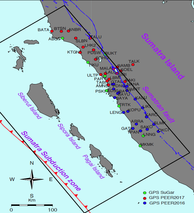
Project GPS locations. |
The Mentawai patch of the Sumatra subduction zone is locked and likely to produce a large earthquake in the near future (Chlieh et. al., 2008). The potential for this patch to rupture makes it very important to estimate future seismic and tsunami hazards that may ensue as a result. To get a better idea of future hazards, a better understanding of historical earthquakes on this patch is needed. To this end, the project team will use the earthquake cycle model to estimate the historical slip distributions though inversion of the paleogeodetic data. To better understand future tsunami hazards, we need to know how the patch will rupture in the future. The low-lying coastal Sumatran city of Padang has been the object of many research and outreach efforts, especially since the tsunami of 2004. However, there remain significant barriers to linking science to risk reduction: hazard information is sometimes contradictory or confusing for non-scientists and critical misunderstandings remain.
This three-year project aims to investigate and re-locate the source of earthquakes of the Mentawai seismic gap by densify the GPS network in West Sumatra. This will include training students from Bengkulu University in collecting and processing GPS data to model historical earthquakes in this region and simulate crustal deformation for earthquake cycles. They will also investigate tsunami height based on various models. To help prepare for potential future disasters, they will build partnerships among scientists, outreach workers, NGOs, and government officials in order to link science to risk-reduction practice. They will be leveraging the experience of their U.S. Government-supported partner, who has experience in methods of developing community resilience to disaster and policies for earthquake and tsunami hazards mitigation.
These researchers also plan to integrate earthquake education and curriculum development into their Global Positioning System (GPS) field surveys. Most of the GPS stations they will install will be in schoolyards. Undergraduate faculty-in-training from Bengkulu University will join the GPS field teams to develop, test, and refine lessons about earthquakes and ways to reduce risk. The project team will supervise undergraduate students in designing and implementing “go school” efforts and will also provide science and teaching examples for an NGO-led program to integrate disaster-risk reduction into the Padang city schools’ curriculum. This provides an excellent opportunity for educating local communities about earthquakes because the undergraduates will serve as effective role models for the younger school students, inspiring them to stay in school and encouraging them to study science. The project team will work with the Padang government to present and explain their results, including tsunami and hazard maps, as well as an assessment of potential impacts at the district and city levels. This will help local governments in at-risk communities to prepare for natural earthquake and tsunami hazards and will contribute to redefining the science of community resilience.
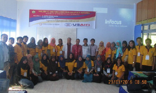 | | 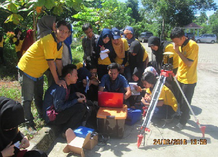 | | Attendees of the GPS data acquisition workshop at Bengkulu University. | | The PI instructs members of the project team on data collection (photos courtesy of Dr. Lubis). |
Summary of Recent Activities
On July 17-18, 2019, Dr. Lubis and his team conducted a dissemination workshop on their PEER project for local government officials and other stakeholders in Padang city. The participants included representatives from the local Agency for Disaster Countermeasures (BPPD), the local Department of Public Works (Dinas PU), and the local Department of Education (Dinas Pendidikan). The researchers provided background information on Padang’s history of impacts from earthquakes and tsunamis and the risks it faces due to its location in a zone with active earthquake generators such as the Sunda Megathrust and the Sumatra Fault zone. The workshop also aimed to dissemination the research findings and recommendations from the PEER study in order to help local government decision makers to shape policies that would strengthen the city’s awareness about earthquake and tsunami risks, as well as to help them prepare in case such natural hazards occur. The team outlined some key points of vulnerability, the role and limits of building codes, and resilience as a mantra of government preparedness. Understanding hazards and vulnerability ahead of time will help city officials determine which buildings and assets are most critical and then design and invest for greater resilience based on a hierarchical scale of risk. Being aware of current seismic data from the Meteorology, Climatology and Geophysical Agency of Indonesia (BMKG) is therefore crucial. Other key topics covered were earthquake building codes and the need to prepare public utility lifelines such as electricity and water services.
In addition to this dissemination workshop, the PI and his group have also delivered 1,000 pocket-sized booklets for students at schools in Padang city that contain information on actions the students should take during natural disasters. The booklets also provided background information regarding the risks of potential earthquakes on the Mentawai segment, the part of the Sunda Megathrust fault that lies near Padang. Although the project is scheduled to end at the end of September 2019, Dr. Lubis and his colleagues also continue to prepare two journal articles related to past and present-day seismic status on the Mentawai segment. 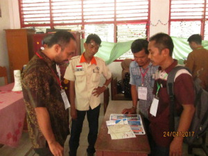 | 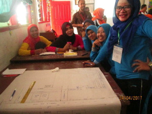 | 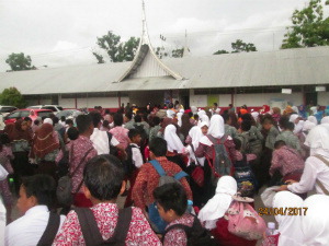 | | Explaining evacuation procedures to local NGO and community representatives | Teachers recognize their local school environment and develop evacuation maps | Students instructed to assemble in school yard upon hearing evacuation sirens |
Photos courtesy of Dr. Lubis
Back to PEER Cycle 4 Grant Recipients
| 


