Water availability and accessibility are concerns that water managers strive to address in the face of climate change, population growth, and food insecurity. Water resources are strained during extreme hydrologic events, and as climate variability and extremes increase (Trenberth, 2012), the uncertainty of freshwater availability poses a threat for emerging economies like Uganda. Anecdotal reports from Uganda indicate that shrinking rivers and diminishing groundwater resources (Lwanga, 2015) have become commonplace, both of which indicate declines in groundwater storage. Water harvesting has the potential to mitigate climate impacts in the short-term (Kahinda et al., 2010); however, potential hydrologic alterations from such small-scale water captures and storage are unknown.
This study sought to assess the viability of increasing water harvesting efforts in Uganda by examining associated hydrological impacts that result from the capture and storage of water. Dr. Nanteza and her team applied an integrated modelling framework to exploit multivariate remote sensing data from NASA satellite missions combined with ground-based hydrologic observations to examine the spatial and temporal impacts of water harvesting. This project served as a pilot study for model development and hypothesis testing, thus providing a first step towards generation of a decision-support system for evaluating water use and management scenarios in the face of climate change and development. The research team also addressed broader national development goals, including aiding decision making for development efforts towards irrigation-based agricultural production, as well as livelihoods. Results of the study should help to inform ongoing government efforts (for example, the Karamoja Action Plan for Food Security) aimed at transitioning the Karamoja dry-land communities from pastoralism to crop farming.
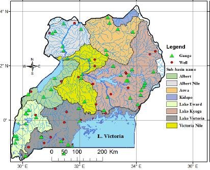
Final Summary of Project ActivitiesIn the course of the project the team worked to identify and characterize recharge, low flow and groundwater behaviors across temporal and spatial scales with links to land use and climate changes, They used a multi-model ensemble of eight global hydrological models (GHMs) of the Inter-Sectoral Impact Model Intercomparison Project (ISIMIP2b) that are driven by the bias-adjusted output of four global circulation models (GCMs). The team assessed the space-time variability in groundwater recharge and the recharge/precipitation ratio and identified areas potentially at risk to future groundwater shortages over Uganda. In 2022, the team published a paper detailing their findings.
The second objective of the project was to quantify and characterize the spatiotemporal groundwater use and water harvesting across the country with links to socio-economic factors and population dynamics. First, the team aimed to examine the status of groundwater and rainwater harvesting supply systems in Uganda, and second, they worked to determine the current rates of groundwater abstracted and rainwater harvested in Uganda as these would further inform the experimental modelling efforts. The researchers further compared this potential with required tank storage (RTS) capacities based on user population, demand and dry period lengths, to examine whether existing rooftop areas in Uganda and tank storage can sustainably supply water for use during 90-day and 180-day dry periods.
Quantifying the runoff, recharge and groundwater storage alterations resulting from water harvesting operations was the project team's third objective. The study used the Community Land Model (CLM4) to evaluate the hydrologic impacts of increasing water abstraction over Uganda. The model was modified to include rainwater and groundwater harvesting. The study results show that current water harvesting practices have no significant hydrologic impacts. However, scenario based analysis shows that if water harvesting is increased especially from aquifers it would lead to a decrease (increase) in base flow, water table depth, surface runoff (evaporation, groundwater recharge, soil moisture and infiltration).
The project achieved significant developmental impacts through a number of initiatives. They trained 105 students and researchers on NASA's satellite and hydrologic models, aiming to enhance research quality in water resource management. Additionally, 80 undergraduates and 22 Master's students were trained on pressure transducers for groundwater monitoring, and 20 students learned the CLM model for hydrologic evaluations. The project generated datasets on water abstraction and rainwater harvesting potential across Uganda, facilitating spatial analysis for water development projects. Collaborations with the Ministry of Water and Environment and local governments enabled local water managers to monitor equipment and utilize data effectively. Digitized datasets on rooftop areas for rainwater harvesting were also created, influencing decisions on future projects. Winning the bid to host the African Union New Partnership for Africa’s Development center of excellence in water underscores the project's enduring impact, ensuring continued implementation of its recommendations beyond its conclusion.
PublicationJamiat Nanteza, Brian Thomas, Jesse Kisembe, Rhoda Nakabugo, Paul Isolo Mukwaya, and Mathew Rodell. 2022. A Google Earth-GIS based approach to examine the potential of the current rainwater harvesting practices to meet water demands in Mityana district, Uganda.
PLOS Water 1(11): e0000045.
https://doi.org/10.1371/journal.pwat.0000045